Buildings and facades
Use orbit-style coverage for structures with vertical faces and details.

Use aerial and outdoor capture data to generate browser-ready 3D scenes. FreeGaussian helps turn structured drone footage and photo passes into realistic spatial previews.
Best paths
Capture buildings, landscapes, facades, paths, and open areas.
Use structured paths to reduce holes and capture vertical faces.
Use private processing when drone data belongs to clients or sites.
For aerial reconstruction
Drone workflows are useful for large outdoor environments, facades, landscapes, and commercial sites. Good flight planning and overlap make the final splat more stable and complete.
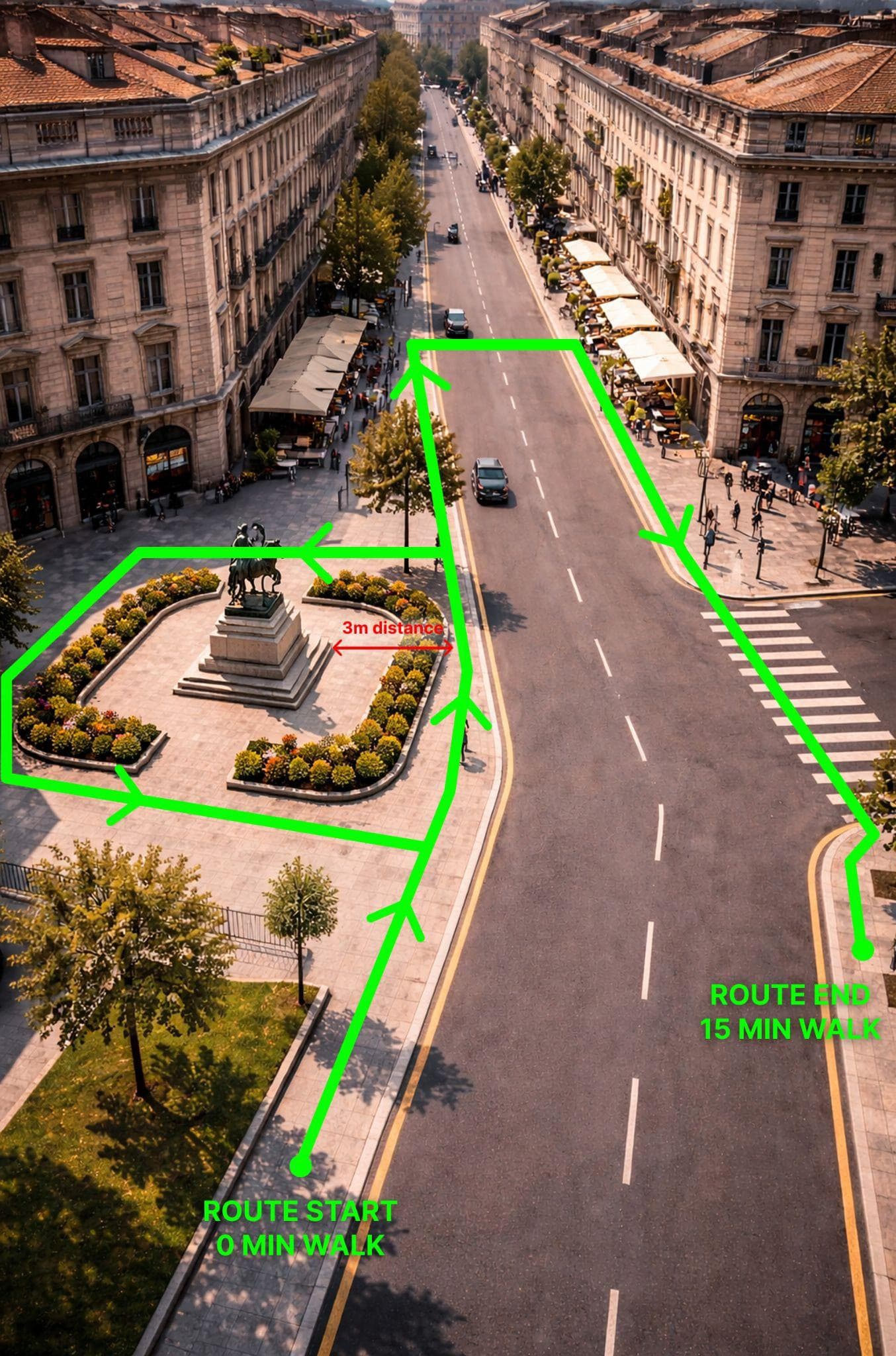
Document outdoor spaces and structures that are hard to capture from the ground alone.
Combine grids, orbits, and detail passes to capture both horizontal and vertical surfaces.
Stable light and controlled motion reduce flicker, glare, and reconstruction artifacts.
Flight planning
Structured coverage matters. Use overlapping passes, oblique angles, and steady motion to give the reconstruction enough visual evidence.
Drone workflow
Drone use cases
Use orbit-style coverage for structures with vertical faces and details.
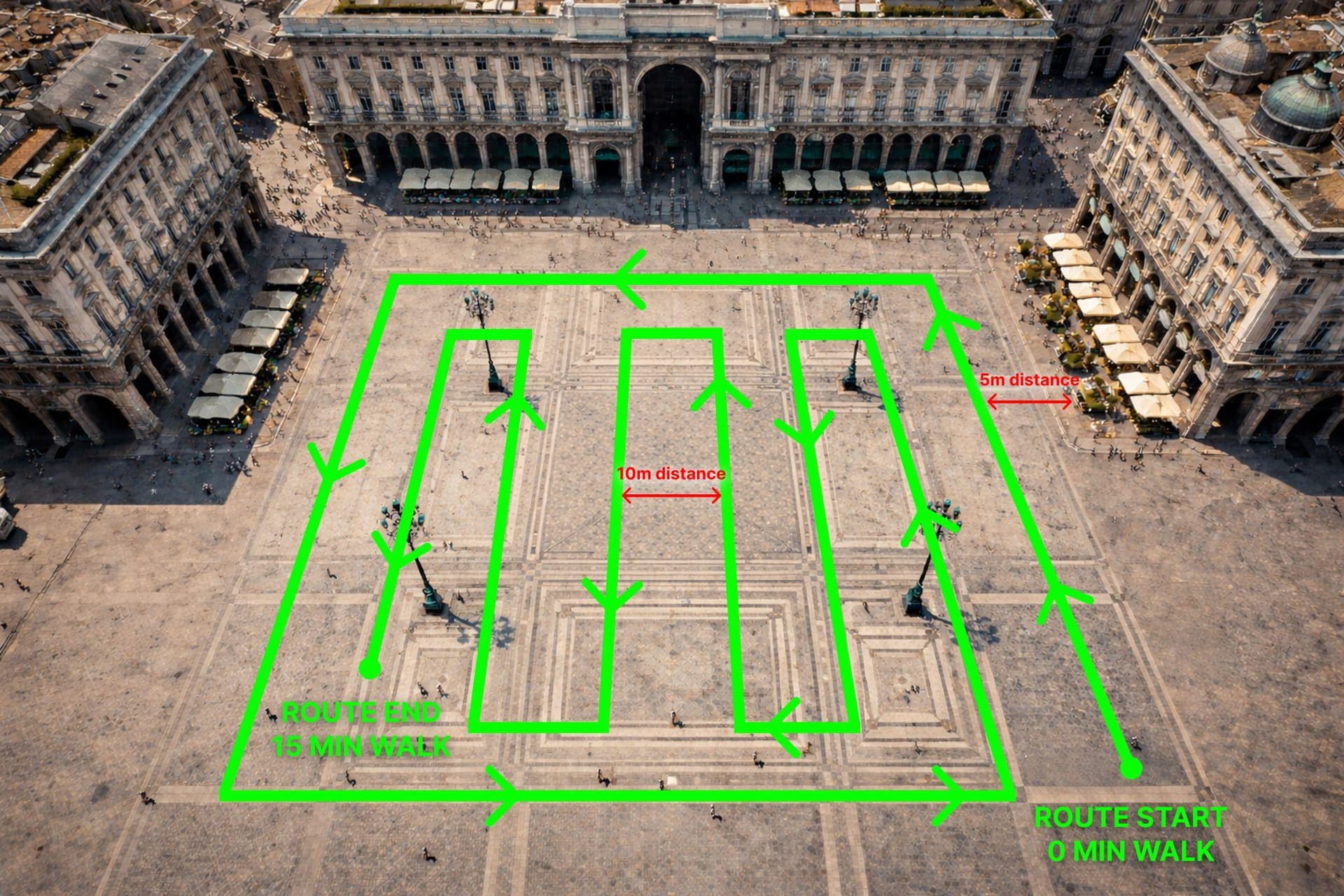
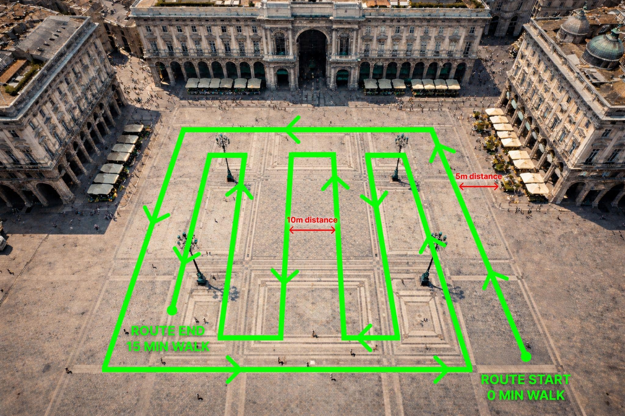
Capture broad environments with grids, perimeter passes, and overlap.
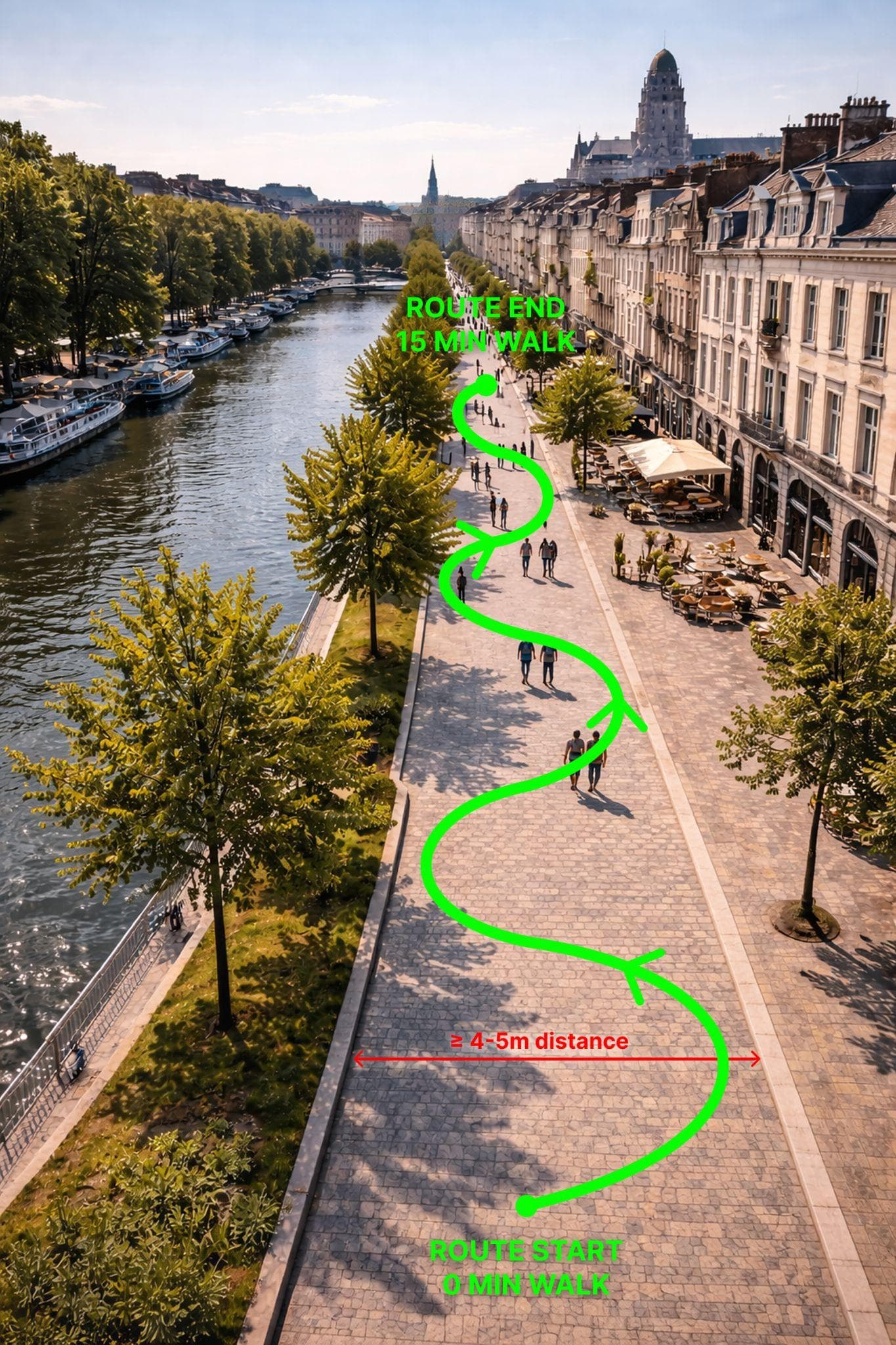
Document walkable outdoor routes, gardens, approaches, and site context.
Drone Gaussian Splatting works best when the source data has steady movement, sufficient overlap, and coverage from multiple angles.
Useful for broad horizontal coverage and open outdoor spaces.
Capture facades and structures from oblique angles.
Recommended for client sites, commercial data, and sensitive locations.
Ready to generate